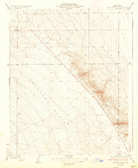
1936 Map of Antelope Plain
USGS Topo · Published 1936About this map
The Lost Hills rise sharply from the floor of the Antelope Plain in this 1932 topographic survey of western Kern County. The landscape is defined by the stark contrast between the low-lying plain and the complex contour lines of the hills, where the elevation changes reveal the geologic structure that would become central to California's petroleum industry. Mapping of this area was completed under the direction of Edward Hyatt, State Engineer, and Governor Frank F. Merriam. While the terrain appears largely unsettled, a solitary Well is marked near the center of the sheet, signaling the early exploration and resource development taking place in this part of the San Joaquin Valley. This map provides a clear view of the natural topography before the extensive industrialization and road networks of the mid-20th century transformed the region.
Find a feature on this map
5 named features on this map. Tap any name to fly to it.
Don’t see what you’re looking for? This feature index may not catch every label — zoom into the map to look around manually.
Map Details
Editions of this 1936 Antelope Plain Map
3 editions found
Other maps of this area

1914 · Lost Hills
USGS Topo · 1:125,000

1930 · Avenal Gap
USGS Topo · 1:31,680

1932 · Antelope Plain
USGS Topo · 1:31,680

1932 · West of Goose Lake
USGS Topo · 1:31,680

1932 · Reynolds Ranch
USGS Topo · 1:31,680

1932 · West Camp
USGS Topo · 1:31,680

1932 · Lone Tree Well
USGS Topo · 1:31,680

1933 · Avenal Gap
USGS Topo · 1:31,680

1934 · West of Goose Lake
USGS Topo · 1:31,680
1935 · West Camp
USGS Topo · 1:31,680