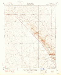
1936 Map of Antelope Plain
USGS Topo · Published 1947About this map
The Lost Hills rise sharply from the western floor of the San Joaquin Valley in this 1932 topographic study, revealing the complex geological folds of the southern California oil country. The landscape is defined by the stark transition from the flat Antelope Plain to the ridgelines that characterize this petroleum-producing region. Surveyed by S.C. Kain and represented by the Director of Public Works, the map documents an industrial frontier where a lone Well serves as a primary landmark in an otherwise arid expanse. The detailed five-foot contour intervals highlight the subtle drainage patterns and structural elevations that guided early 20th-century oil exploration and land development long before the modern infrastructure of Kern County was fully established.
Find a feature on this map
4 named features on this map. Tap any name to fly to it.
Don’t see what you’re looking for? This feature index may not catch every label — zoom into the map to look around manually.
Map Details
Editions of this 1936 Antelope Plain Map
3 editions found
Other maps of this area

1914 · Lost Hills
USGS Topo · 1:125,000

1930 · Avenal Gap
USGS Topo · 1:31,680

1932 · Antelope Plain
USGS Topo · 1:31,680

1932 · West of Goose Lake
USGS Topo · 1:31,680

1932 · Reynolds Ranch
USGS Topo · 1:31,680

1932 · West Camp
USGS Topo · 1:31,680

1932 · Lone Tree Well
USGS Topo · 1:31,680

1933 · Avenal Gap
USGS Topo · 1:31,680

1934 · West of Goose Lake
USGS Topo · 1:31,680
1935 · West Camp
USGS Topo · 1:31,680