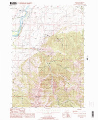
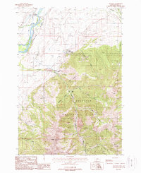
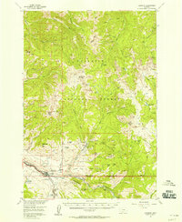
1988 Map of Emigrant
USGS Topo · Published 1988About this map
Yellowstone River flows through the northern reaches of Paradise Valley, framing a landscape defined by the transition from river bottomlands to the high peaks of the Gallatin National Forest. This 1980s-era survey captures several established community centers, including the historic resort area at Chico Hot Springs and the nearby settlement of Chico. The presence of Tailings and numerous Prospects along Emigrant Creek points to the area's long-standing connection to mineral extraction, particularly near the St Julian Mine on the slopes of Emigrant Peak. Local heritage is anchored by landmarks like St Johns Church and the Chico Cemetery, while the varied terrain of Conlin Gulch and Maze Gulch illustrates the complex drainage patterns feeding the main river valley.
Find a feature on this map
30 named features on this map. Tap any name to fly to it.
Don’t see what you’re looking for? This feature index may not catch every label — zoom into the map to look around manually.
Map Details
Editions of this 1988 Emigrant Map
2 editions found
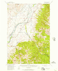
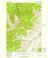
Other maps of this area

1891 · Livingston
USGS Topo · 1:250,000

1893 · Livingston
USGS Topo · 1:250,000

1947 · Bozeman
USGS Topo · 1:250,000

1948 · Bozeman
USGS Topo · 1:250,000

1955 · Bozeman
USGS Topo · 1:250,000
1955 · Emigrant
USGS Topo · 1:62,500
1955 · Fridley Peak
USGS Topo · 1:62,500
1955 · Gardiner
USGS Topo · 1:62,500
1955 · Miner
USGS Topo · 1:62,500

1958 · Bozeman
USGS Topo · 1:250,000