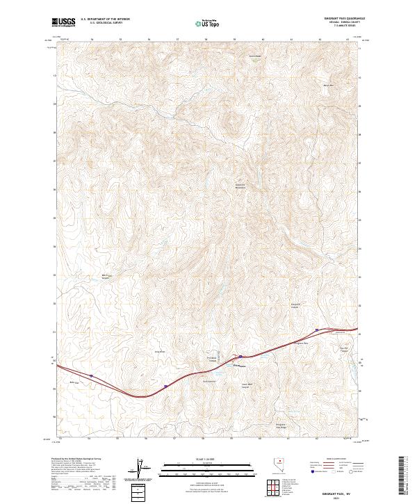
2021 Map of Emigrant Pass
USGS Topo · Published 2021About this map
Emigrant Pass serves as a critical geographic corridor through the Tuscarora Mountains, a landscape defined by its high-altitude water sources and steep canyons. The small settlement of Primeaux is situated at the intersection of several topographic features, including Primeaux Canyon and the notable Twin Summit. This modern survey reveals a network of vital watering points such as Emigrant Spring, Highway Spring, and Fish Pond Spring, which trace the historical movement of travelers through the high desert of Eureka County. The northern terrain is dominated by the heights of Carlin Peaks and Marys Mtn, giving way to lower drainages like Bob Cr and Marys Cr. The presence of Bobs Flat and the namesake Emigrant Pass Ridge illustrates the complex relief of this mountain range, where modern infrastructure follows established routes through narrow gaps and across wide draws.
Find a feature on this map
29 named features on this map. Tap any name to fly to it.
Don’t see what you’re looking for? This feature index may not catch every label — zoom into the map to look around manually.
Map Details
Editions of this 2021 Emigrant Pass Map
This is the sole edition of this map. No revisions or reprints were ever made.
Other maps of this area

1952 · Carlin
USGS Topo · 1:62,500

1955 · Winnemucca
USGS Topo · 1:250,000

1957 · Beowawe
USGS Topo · 1:62,500

1958 · Winnemucca
USGS Topo · 1:250,000

1962 · Winnemucca
USGS Topo · 1:250,000

1968 · Rodeo Creek SW
USGS Topo · 1:24,000

1968 · Welches Canyon
USGS Topo · 1:24,000
1968 · Schroeder Mtn
USGS Topo · 1:24,000

1985 · Scotts Gulch
USGS Topo · 1:24,000
1985 · Palisade
USGS Topo · 1:24,000