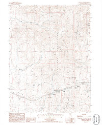
1986 Map of Emigrant Pass
USGS Topo · Published 1986About this map
Emigrant Pass serves as a critical point of navigation through the high country of Nevada, marking a passage through the Tuscarora Mountains and the Emigrant Pass Ridge. The landscape is defined by its water sources, which were historically vital for travelers, including Primeaux Springs, Fish Pond Spring, and the aptly named Emigrant Spring. To the west, the broad expanse of Bobs Flat and Long Draw provide a stark contrast to the surrounding peaks.
Find a feature on this map
31 named features on this map. Tap any name to fly to it.
Don’t see what you’re looking for? This feature index may not catch every label — zoom into the map to look around manually.
Map Details
Editions of this 1986 Emigrant Pass Map
This is the sole edition of this map. No revisions or reprints were ever made.
Other maps of this area

1952 · Carlin
USGS Topo · 1:62,500

1955 · Winnemucca
USGS Topo · 1:250,000

1957 · Beowawe
USGS Topo · 1:62,500

1958 · Winnemucca
USGS Topo · 1:250,000

1962 · Winnemucca
USGS Topo · 1:250,000

1968 · Rodeo Creek SW
USGS Topo · 1:24,000

1968 · Welches Canyon
USGS Topo · 1:24,000
1968 · Schroeder Mtn
USGS Topo · 1:24,000

1985 · Scotts Gulch
USGS Topo · 1:24,000
1985 · Palisade
USGS Topo · 1:24,000