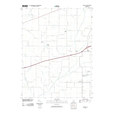
2010 Map of Eminence
USGS Topo · Published 2010About this map
Mill Creek and its many tributaries, including Cotton Branch and Belle Union Branch, define the rural geography of this corner of Indiana. Small crossroads settlements like Belle Union and Eminence anchor a grid of county roads that have remained largely consistent since the mid-20th century. In the northern reaches, Broad Park sits near the headwaters of Sallust Branch, while the southeastern corner is marked by Whispering Wind Lake and the Whispering Wind Lake Dam. For the family historian, the map preserves the exact locations of local burial grounds such as Mill Creek Cemetery, Walters Cemetery, and the Whitaker-Patrick Cemetery. The landscape is a transition between the managed drainage of Lake Ditch and the natural meanders of Rhodes Creek and Vermillion Branch.
Find a feature on this map
71 named features on this map. Tap any name to fly to it.
Don’t see what you’re looking for? This feature index may not catch every label — zoom into the map to look around manually.
Map Details
Editions of this 2010 Eminence Map
This is the sole edition of this map. No revisions or reprints were ever made.
Other maps of this area

1949 · Quincy
USGS Topo · 1:24,000

1953 · Clayton
USGS Topo · 1:24,000

1953 · Indianapolis
USGS Topo · 1:250,000

1955 · Hall
USGS Topo · 1:24,000

1956 · Indianapolis
USGS Topo · 1:250,000

1956 · Cloverdale
USGS Topo · 1:24,000

1956 · Cataract
USGS Topo · 1:24,000

1956 · Eminence
USGS Topo · 1:24,000

1957 · Indianapolis
USGS Topo · 1:250,000
1957 · Paragon
USGS Topo · 1:24,000