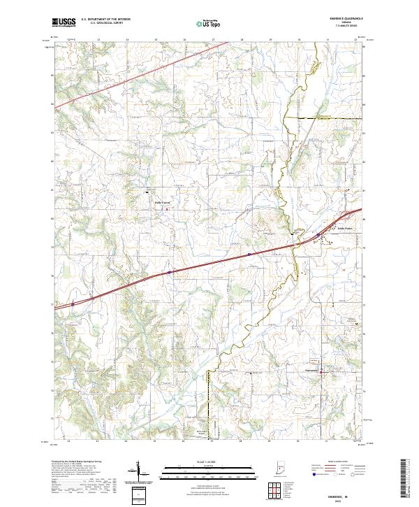
2022 Map of Eminence
USGS Topo · Published 2022About this map
Mill Creek and its complex network of tributaries, including Mill Creek Ditch and Lake Ditch, define the landscape of this rural Indiana corridor. The area is anchored by several long-standing unincorporated communities, notably Eminence and Belle Union, where the local heritage is preserved in family and community burial grounds such as Mill Creek Cem and Walters Cem. The landscape reflects a transition from traditional agricultural patterns to more modern utility, seen in the presence of Pam's Place Airport and the residential development near Whispering Wind Lake. Transport and trade are shaped by the converging boundaries of Putnam, Morgan, and Hendricks counties, with the small settlement of Little Point situated near a major thoroughfare. The numerous branches—Cotton Br, Belle Union Br, and Vermillion Br—suggest a historically well-watered territory where drainage and irrigation projects like Mud Creek have historically supported the region's farming economy.
Find a feature on this map
95 named features on this map. Tap any name to fly to it.
Don’t see what you’re looking for? This feature index may not catch every label — zoom into the map to look around manually.
Map Details
Editions of this 2022 Eminence Map
This is the sole edition of this map. No revisions or reprints were ever made.
Other maps of this area

1949 · Quincy
USGS Topo · 1:24,000

1953 · Clayton
USGS Topo · 1:24,000

1953 · Indianapolis
USGS Topo · 1:250,000

1955 · Hall
USGS Topo · 1:24,000

1956 · Indianapolis
USGS Topo · 1:250,000

1956 · Cloverdale
USGS Topo · 1:24,000

1956 · Cataract
USGS Topo · 1:24,000

1956 · Eminence
USGS Topo · 1:24,000

1957 · Indianapolis
USGS Topo · 1:250,000
1957 · Paragon
USGS Topo · 1:24,000