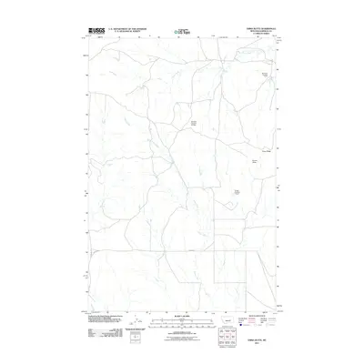
2011 Map of Emma Butte
USGS Topo · Published 2011About this map
Emma Butte and the surrounding terrain of Garfield County, Montana, are defined by a network of drainage systems and isolated water management structures in this 2011 survey. The landscape is carved by the winding paths of Indian Creek and Sand Creek, which dictate the local topography and the placement of early 21st-century infrastructure. Land use in this part of the state is represented by several numbered water control points, including the Montana Number 28 Dam, Severson Number 4 Dam, and Gregg Number 1 Dam. These features, alongside the prominent elevation of Piney Ridge, suggest a reliance on seasonal water management in a region where natural flow is intermittent. Access to this territory is maintained through rural routes such as Gregg Rd and Edwards Rd, which serve as the primary links through the open range.
Find a feature on this map
9 named features on this map. Tap any name to fly to it.
Don’t see what you’re looking for? This feature index may not catch every label — zoom into the map to look around manually.
Map Details
Editions of this 2011 Emma Butte Map
This is the sole edition of this map. No revisions or reprints were ever made.
Other maps of this area

1954 · Jordan
USGS Topo · 1:250,000

1954 · Forsyth
USGS Topo · 1:250,000

1956 · Jordan
USGS Topo · 1:250,000

1957 · Forsyth
USGS Topo · 1:250,000

1958 · Jordan
USGS Topo · 1:250,000

1958 · Forsyth
USGS Topo · 1:250,000

1964 · Jordan
USGS Topo · 1:250,000

1965 · Robertson School
USGS Topo · 1:24,000
1965 · Sand Springs
USGS Topo · 1:24,000

1965 · Hole-In-The-Rock
USGS Topo · 1:24,000