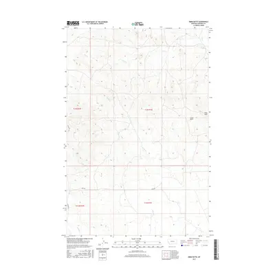
2017 Map of Emma Butte
USGS Topo · Published 2017About this map
Emma Butte stands as a prominent landmark in this portion of Garfield County, marking the high ground of a vast, dissected plateau. This 2017 survey details the drainage patterns of the northern Great Plains, where seasonal waterways like Sand Cr and Indian Cr carve intricate coulees through the landscape. The terrain is characterized by broad ridges and narrow draws, with Piney Ridge providing a distinct elevated break in the topography. Rural infrastructure is sparse, defined primarily by the presence of Ingomar Rd and Gregg Rd, which serve as the primary conduits through these expansive ranchlands. In the southern reaches of the map, McGinnis Cr flows through the township blocks, illustrating the systematic grid of public land surveys that organized this region of Montana. The map provides a clear record of land divisions and topographical elevations across T14N and T13N, essential for understanding the spatial organization of this open country.
Find a feature on this map
11 named features on this map. Tap any name to fly to it.
Don’t see what you’re looking for? This feature index may not catch every label — zoom into the map to look around manually.
Map Details
Editions of this 2017 Emma Butte Map
This is the sole edition of this map. No revisions or reprints were ever made.
Other maps of this area
1954 · Jordan
USGS Topo · 1:250,000

1954 · Forsyth
USGS Topo · 1:250,000
1956 · Jordan
USGS Topo · 1:250,000

1957 · Forsyth
USGS Topo · 1:250,000
1958 · Jordan
USGS Topo · 1:250,000

1958 · Forsyth
USGS Topo · 1:250,000
1964 · Jordan
USGS Topo · 1:250,000
1965 · Robertson School
USGS Topo · 1:24,000
1965 · Sand Springs
USGS Topo · 1:24,000
1965 · Hole-In-The-Rock
USGS Topo · 1:24,000