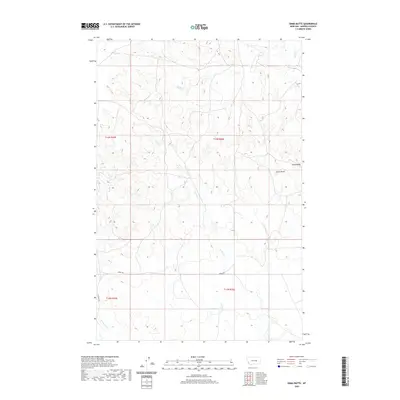
2020 Map of Emma Butte
USGS Topo · Published 2020About this map
Emma Butte stands as a prominent topographic landmark in this section of Garfield County, rising above a landscape defined by seasonal drainages and high ridges. The area is marked by the winding paths of Sand Creek in the north and the extensive reach of Indian Creek, which meanders through the central and southern portions of the quadrangle. This 2020 survey documents a ranching and transition landscape where human infrastructure is sparse, primarily confined to light-duty routes like Gregg Rd and Ingomar Rd. To the east, Piney Ridge provides a distinct linear boundary, while the southwestern corner is drained by McGinnis Creek. The map reflects the enduring rural character of eastern Montana, capturing the township and range boundaries of t14n r35e and surrounding sections that have shaped land use for generations.
Find a feature on this map
13 named features on this map. Tap any name to fly to it.
Don’t see what you’re looking for? This feature index may not catch every label — zoom into the map to look around manually.
Map Details
Editions of this 2020 Emma Butte Map
This is the sole edition of this map. No revisions or reprints were ever made.
Other maps of this area

1954 · Jordan
USGS Topo · 1:250,000

1954 · Forsyth
USGS Topo · 1:250,000

1956 · Jordan
USGS Topo · 1:250,000

1957 · Forsyth
USGS Topo · 1:250,000

1958 · Jordan
USGS Topo · 1:250,000

1958 · Forsyth
USGS Topo · 1:250,000

1964 · Jordan
USGS Topo · 1:250,000

1965 · Robertson School
USGS Topo · 1:24,000
1965 · Sand Springs
USGS Topo · 1:24,000

1965 · Hole-In-The-Rock
USGS Topo · 1:24,000