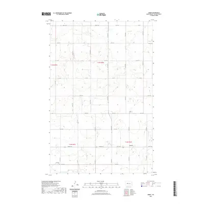
2020 Map of Emmet
USGS Topo · Published 2020About this map
The small unincorporated community of Emmet serves as the central focal point of this McLean County landscape, situated along the intersection of 16th St NW and several rural routes. The map illustrates a strictly organized section-line road grid typical of the Great Plains, featuring routes like Perimeter Road and Co Hwy 6. For genealogists and local historians, several burial grounds provide important spatial landmarks across the prairie, including Assumption Cem in the southwest and Saint Peter Cem further east. Drainage in the southern portion of the quadrangle is defined by the winding course of W Br Douglas Cr, which breaks the otherwise geometric precision of the surveyed agricultural parcels.
Find a feature on this map
20 named features on this map. Tap any name to fly to it.
Don’t see what you’re looking for? This feature index may not catch every label — zoom into the map to look around manually.
Map Details
Editions of this 2020 Emmet Map
This is the sole edition of this map. No revisions or reprints were ever made.
Other maps of this area

1954 · McClusky
USGS Topo · 1:250,000

1956 · Emmet NE
USGS Topo · 1:24,000

1956 · Blackwater Lake
USGS Topo · 1:24,000

1956 · Blue Hill
USGS Topo · 1:24,000

1956 · Emmet
USGS Topo · 1:24,000

1956 · Douglas West
USGS Topo · 1:24,000

1956 · Roseglen
USGS Topo · 1:24,000

1958 · McClusky
USGS Topo · 1:250,000

1967 · Emmet SE
USGS Topo · 1:24,000

1967 · Blackwater Lake SE
USGS Topo · 1:24,000