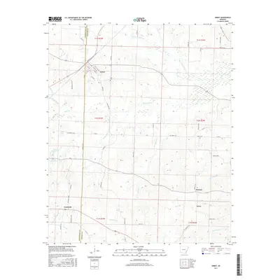
2017 Map of Emmet
USGS Topo · Published 2017About this map
Emmet straddles the county line between Hempstead and Nevada counties, serving as the primary hub for this rural Arkansas landscape. The town is defined by a traditional grid of streets, including S Main St, S Walnut St, and W 1st St, indicating its development as a local center for commerce. Beyond the town limits, the terrain is defined by a dense network of drainage systems, including Little Terre Rouge Cr, Terre Rouge Cr, and Trammel Cr. Genealogists may find interest in the location of Snell Cem situated just east of the main settlement. Further south, the map identifies small rural communities like Centerville, Harmony, and Sutton, which are connected by a web of county roads such as Nevada 33 Rd and Hempstead 124 Rd. Several distinct water bodies, including Catfish Pond and Rolling Hills Pond, are named features that offer specific landmarks for local history researchers.
Find a feature on this map
67 named features on this map. Tap any name to fly to it.
Don’t see what you’re looking for? This feature index may not catch every label — zoom into the map to look around manually.
Map Details
Editions of this 2017 Emmet Map
This is the sole edition of this map. No revisions or reprints were ever made.
Other maps of this area
1901 · Gurdon
USGS Topo · 1:125,000
1951 · Blevins
USGS Topo · 1:24,000
1951 · Patmos
USGS Topo · 1:24,000
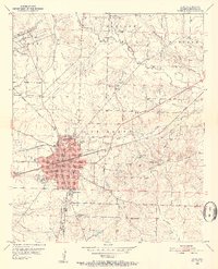
1951 · Hope
USGS Topo · 1:24,000

1953 · El Dorado
USGS Topo · 1:250,000
1957 · El Dorado
USGS Topo · 1:250,000
1958 · El Dorado
USGS Topo · 1:250,000
1960 · El Dorado
USGS Topo · 1:250,000
1970 · Prescott East
USGS Topo · 1:24,000
1970 · Prescott West
USGS Topo · 1:24,000