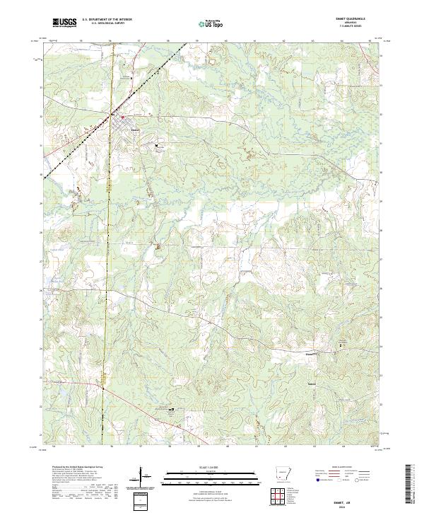
2024 Map of Emmet
USGS Topo · Published 2024About this map
Emmet straddles the county line between Hempstead and Nevada counties, serving as a primary point of settlement in this Southwest Arkansas landscape. The town's grid is well-defined by streets such as S Main St and S Walnut St, while the surrounding rural areas are marked by a significant concentration of communal and genealogical sites. Notable among these is the Briant Cem African American near the southern edge, alongside other family and community burial grounds including Snell Cem and Ephesus Cem.
Find a feature on this map
76 named features on this map. Tap any name to fly to it.
Don’t see what you’re looking for? This feature index may not catch every label — zoom into the map to look around manually.
Map Details
Editions of this 2024 Emmet Map
This is the sole edition of this map. No revisions or reprints were ever made.
Other maps of this area

1901 · Gurdon
USGS Topo · 1:125,000

1951 · Blevins
USGS Topo · 1:24,000

1951 · Patmos
USGS Topo · 1:24,000

1951 · Hope
USGS Topo · 1:24,000

1953 · El Dorado
USGS Topo · 1:250,000

1957 · El Dorado
USGS Topo · 1:250,000

1958 · El Dorado
USGS Topo · 1:250,000

1960 · El Dorado
USGS Topo · 1:250,000

1970 · Prescott East
USGS Topo · 1:24,000
1970 · Prescott West
USGS Topo · 1:24,000