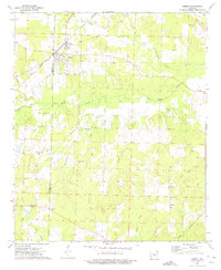
1973 Map of Emmet
USGS Topo · Published 1975About this map
Emmet serves as the primary hub of this rural landscape, situated along the Missouri Pacific railroad and Highway 67. The map illustrates a community anchored by numerous local congregations, including Ephesus Ch, New Liberty Ch, and Sweet Home Ch, which are scattered throughout the countryside. These landmarks, along with the Snell Cem, provide specific points of interest for genealogists tracing family roots in this part of Hempstead and Nevada Counties.
Find a feature on this map
33 named features on this map. Tap any name to fly to it.
Don’t see what you’re looking for? This feature index may not catch every label — zoom into the map to look around manually.
Map Details
Editions of this 1973 Emmet Map
This is the sole edition of this map. No revisions or reprints were ever made.
Other maps of this area

1901 · Gurdon
USGS Topo · 1:125,000

1951 · Blevins
USGS Topo · 1:24,000

1951 · Patmos
USGS Topo · 1:24,000

1951 · Hope
USGS Topo · 1:24,000

1953 · El Dorado
USGS Topo · 1:250,000

1957 · El Dorado
USGS Topo · 1:250,000

1958 · El Dorado
USGS Topo · 1:250,000

1960 · El Dorado
USGS Topo · 1:250,000

1970 · Prescott East
USGS Topo · 1:24,000
1970 · Prescott West
USGS Topo · 1:24,000