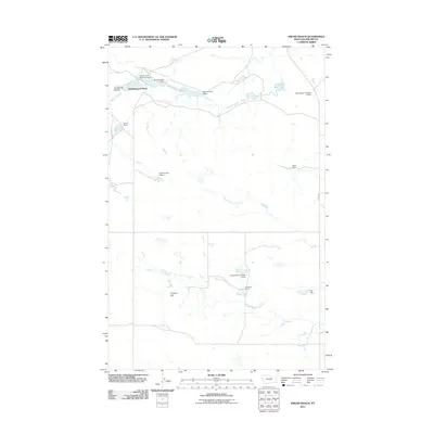
2011 Map of Emond Ranch
USGS Topo · Published 2011About this map
Old Whitcomb Place and other family-named rangeland sites define this Montana landscape, where the management of water is central to the area's utility. Scattered throughout Phillips County, numerous small-scale reservoirs and dams indicate the historical and contemporary importance of irrigation and livestock watering in a high-plains environment. Significant water control structures such as David Drum Number 4 Dam and Hand Number 2 Dam along the course of Beaver Creek illustrate the modification of the natural drainage system. Further south, the landscape is shaped by the North Fork First Creek and First Creek drainages. The presence of the Emond Ranch and Peigneux Ranch alongside features like Lonesome Coulee highlights the traditional ranching heritage that persists in this part of the state, connected by rural routes such as Regina Rd.
Find a feature on this map
17 named features on this map. Tap any name to fly to it.
Don’t see what you’re looking for? This feature index may not catch every label — zoom into the map to look around manually.
Map Details
Editions of this 2011 Emond Ranch Map
This is the sole edition of this map. No revisions or reprints were ever made.
Other maps of this area

1953 · Havre
USGS Topo · 1:250,000

1954 · Jordan
USGS Topo · 1:250,000

1954 · Glasgow
USGS Topo · 1:250,000

1954 · Lewistown
USGS Topo · 1:250,000

1956 · Jordan
USGS Topo · 1:250,000

1957 · Glasgow
USGS Topo · 1:250,000

1957 · Havre
USGS Topo · 1:250,000

1958 · Glasgow
USGS Topo · 1:250,000

1958 · Jordan
USGS Topo · 1:250,000

1958 · Havre
USGS Topo · 1:250,000