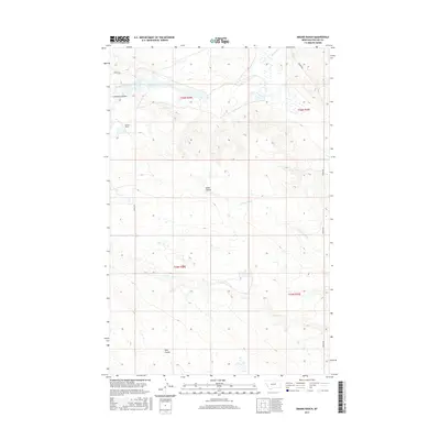
2017 Map of Emond Ranch
USGS Topo · Published 2017About this map
Emond Ranch stands as a focal point in this portion of Phillips County, where the high plains landscape is defined by a network of seasonal drainages and coulees. The northern reaches are shaped by Beaver Creek, which meanders through a broad valley floor, while further south the terrain is dissected by Lonesome Coulee, Alkali Coulee, and Tank Coulee. These features represent the characteristic erosional patterns of the Montana prairie, providing vital geographic markers for local land management and historical ranching operations.
Find a feature on this map
15 named features on this map. Tap any name to fly to it.
Don’t see what you’re looking for? This feature index may not catch every label — zoom into the map to look around manually.
Map Details
Editions of this 2017 Emond Ranch Map
This is the sole edition of this map. No revisions or reprints were ever made.
Other maps of this area
1953 · Havre
USGS Topo · 1:250,000
1954 · Jordan
USGS Topo · 1:250,000

1954 · Glasgow
USGS Topo · 1:250,000
1954 · Lewistown
USGS Topo · 1:250,000
1956 · Jordan
USGS Topo · 1:250,000

1957 · Glasgow
USGS Topo · 1:250,000
1957 · Havre
USGS Topo · 1:250,000

1958 · Glasgow
USGS Topo · 1:250,000
1958 · Jordan
USGS Topo · 1:250,000
1958 · Havre
USGS Topo · 1:250,000