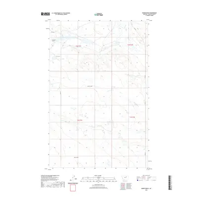
2020 Map of Emond Ranch
USGS Topo · Published 2020About this map
Emond Ranch stands as the central landmark in this portion of Phillips County, Montana, situated amidst a landscape defined by seasonal drainage and ranching infrastructure. The terrain is deeply inscribed by a series of coulees, including the evocative Lonesome Coulee and Alkali Coulee, which channel water toward Beaver Creek in the north or south into the headwaters of First Cr. This 2020 map documents the modern rural network of the region, where gravel and local roads like Ereaux Rd and Regina Rd follow the section lines of the Public Land Survey System, specifically across townships T26N R29E and T25N R30E. The mapping reveals the persistence of isolated ranching outposts in the American West, where small seasonal features like Tank Coulee remain critical identifiers for navigation and land management.
Find a feature on this map
15 named features on this map. Tap any name to fly to it.
Don’t see what you’re looking for? This feature index may not catch every label — zoom into the map to look around manually.
Map Details
Editions of this 2020 Emond Ranch Map
This is the sole edition of this map. No revisions or reprints were ever made.
Other maps of this area

1953 · Havre
USGS Topo · 1:250,000

1954 · Jordan
USGS Topo · 1:250,000

1954 · Glasgow
USGS Topo · 1:250,000

1954 · Lewistown
USGS Topo · 1:250,000

1956 · Jordan
USGS Topo · 1:250,000

1957 · Glasgow
USGS Topo · 1:250,000

1957 · Havre
USGS Topo · 1:250,000

1958 · Glasgow
USGS Topo · 1:250,000

1958 · Jordan
USGS Topo · 1:250,000

1958 · Havre
USGS Topo · 1:250,000