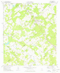
1974 Map of Empire
USGS Topo · Published 1977About this map
The Southern railroad line anchors this rural landscape, connecting the clustered settlements of Frazier, Empire, and Gresston as it cuts diagonally across the terrain. These communities represent the mid-20th-century development of the region, where rail access facilitated local commerce and movement between Bleckley and Dodge counties. The map captures a high density of rural religious and commemorative sites, from the Limestone Memorial Gardens (Cemetery) to smaller family and community burial grounds like Hart Cem and Simmons Cem.
Find a feature on this map
33 named features on this map. Tap any name to fly to it.
Don’t see what you’re looking for? This feature index may not catch every label — zoom into the map to look around manually.
Map Details
Editions of this 1974 Empire Map
This is the sole edition of this map. No revisions or reprints were ever made.
Other maps of this area

1956 · Cochran
USGS Topo · 1:62,500

1957 · Macon
USGS Topo · 1:250,000

1958 · Macon
USGS Topo · 1:250,000

1964 · Macon
USGS Topo · 1:250,000

1972 · Eastman
USGS Topo · 1:24,000

1972 · Finleyson East
USGS Topo · 1:24,000

1972 · West Of Eastman
USGS Topo · 1:24,000
1973 · Hawkinsville
USGS Topo · 1:24,000

1974 · Chester
USGS Topo · 1:24,000
1974 · Yonkers
USGS Topo · 1:24,000