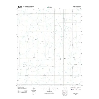
2012 Map of Empire City
USGS Topo · Published 2012About this map
The West Duncan Oil and Gas Field and the Empire Oil Field define the industrial landscape of this Oklahoma region during the early 21st century. The map centers on the small settlements of Empire City and Gas City, illustrating a community deeply intertwined with petroleum extraction. The terrain is marked by a network of drainage systems, including Little Beaver Cr, Walker Cr, and Dry Cr, which wind through the township and range grid. Local infrastructure is revealed through named thoroughfares such as Cemetery Rd, Cattlemans Rd, and the curiously named Dr Pepper Rd. Residential development is visible along Billy Lee Dr and Shady Ln, showing how local housing clusters have formed around the established oil fields and rural section lines.
Find a feature on this map
37 named features on this map. Tap any name to fly to it.
Don’t see what you’re looking for? This feature index may not catch every label — zoom into the map to look around manually.
Map Details
Editions of this 2012 Empire City Map
This is the sole edition of this map. No revisions or reprints were ever made.
Other maps of this area

1901 · Addington
USGS Topo · 1:125,000

1902 · Rush Springs
USGS Topo · 1:125,000

1949 · Nellie
USGS Topo · 1:62,500

1950 · Marlow
USGS Topo · 1:62,500

1951 · Marlow
USGS Topo · 1:62,500

1955 · Lawton
USGS Topo · 1:250,000

1956 · Letitia
USGS Topo · 1:24,000

1956 · Nellie
USGS Topo · 1:24,000

1956 · Nellie
USGS Topo · 1:62,500

1957 · Ardmore
USGS Topo · 1:250,000