2022 Map of Empire City
USGS Topo · Published 2022About this map
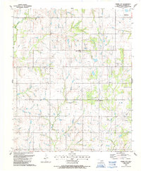
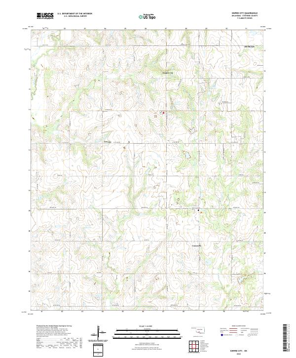
Empire City and the nearby settlement of Gas City are central to this landscape in Stephens County, where the topography is defined by the drainages of Little Beaver Cr and Walker Cr. The road network follows a rigid section-line grid typical of the region, featuring names like Bois D Arc and Refinery Rd, the latter suggesting the historical industrial ties of the local area. Small, named water bodies including 137089 Reservoir and 137017 Reservoir dot the terrain, providing essential water management for the surrounding rural tracts.
Find a feature on this map
28 named features on this map. Tap any name to fly to it.
Don’t see what you’re looking for? This feature index may not catch every label — zoom into the map to look around manually.
Map Details
Editions of this 2022 Empire City Map
This is the sole edition of this map. No revisions or reprints were ever made.
Historical Maps of Duncan Through Time
6 maps found