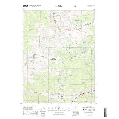
2019 Map of Empire
USGS Topo · Published 2019About this map
James Peak stands at the triple point of Grand, Gilpin, and Clear Creek counties, anchoring a landscape defined by the high-altitude Continental Divide. This 2019 survey documents the rugged geography surrounding the town of Empire, where the W Fork Clear Cr meets several descending gulches. The mapping of the Continental Divide National Scenic Trail as it winds past Mt Flora and Parry Peak highlights the region's importance for alpine transit and recreation. Below the peaks, the drainage patterns of Loch Lomond and Chinns Lake feed the Fall River, illustrating the complex hydrology of the Front Range. Local history is anchored by the small communities of Alice and Lawson, while the Empire Cem and Alvorado Cem provide specific points of interest for genealogists tracing the early mining and ranching families of this high-country corridor.
Find a feature on this map
90 named features on this map. Tap any name to fly to it.
Don’t see what you’re looking for? This feature index may not catch every label — zoom into the map to look around manually.
Map Details
Editions of this 2019 Empire Map
This is the sole edition of this map. No revisions or reprints were ever made.
Other maps of this area

1903 · Georgetown
USGS Topo · 1:62,500

1905 · Central City
USGS Topo · 1:62,500

1905 · Georgetown
USGS Topo · 1:62,500

1910 · Central City
USGS Topo · 1:62,500

1912 · Central City
USGS Topo · 1:62,500

1924 · Montezuma
USGS Topo · 1:62,500

1924 · Fraser
USGS Topo · 1:62,500

1926 · Fraser
USGS Topo · 1:62,500

1926 · Montezuma
USGS Topo · 1:62,500

1933 · Montezuma
USGS Topo · 1:62,500