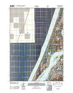
2011 Map of Empire
USGS Topo · Published 2011About this map
Empire serves as a focal point along the eastern shore of the Coos River, illustrating the industrial and civic layout of this coastal Oregon community during the early 21st century. The map details a mix of residential streets and essential services, including the Empire Post Office and the Empire Cemetery. To the south, the Ocean View Memorial Gardens and Radar Hill provide geographical context to the town's expansion.
Find a feature on this map
32 named features on this map. Tap any name to fly to it.
Don’t see what you’re looking for? This feature index may not catch every label — zoom into the map to look around manually.
Map Details
Editions of this 2011 Empire Map
This is the sole edition of this map. No revisions or reprints were ever made.
Other maps of this area

1896 · Coos Bay
USGS Topo · 1:125,000

1898 · Coos Bay
USGS Topo · 1:125,000

1900 · Coos Bay
USGS Topo · 1:125,000

1923 · Reedsport
USGS Topo · 1:62,500

1942 · Reedsport
USGS Topo · 1:62,500

1942 · Empire
USGS Topo · 1:62,500

1942 · Coos Bay
USGS Topo · 1:62,500

1944 · Empire
USGS Topo · 1:62,500

1945 · Coos Bay
USGS Topo · 1:62,500

1954 · Coos Bay
USGS Topo · 1:250,000