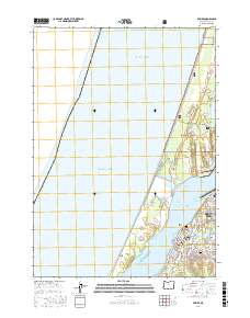
2017 Map of Empire
USGS Topo · Published 2017About this map
Empire and the western edge of North Bend occupy the narrow peninsula between the Pacific Ocean and the intricate waters of Coos Bay. This coastal landscape is defined by the massive North Spit, which shelters the bay and contains the shifting sands of the North Beach and Empire Range. To the north, the Siuslaw National Forest protects a complex of interdunal wetlands including Horsfall Lake and Bluebill Lake.
Find a feature on this map
66 named features on this map. Tap any name to fly to it.
Don’t see what you’re looking for? This feature index may not catch every label — zoom into the map to look around manually.
Map Details
Editions of this 2017 Empire Map
This is the sole edition of this map. No revisions or reprints were ever made.
Other maps of this area

1896 · Coos Bay
USGS Topo · 1:125,000

1898 · Coos Bay
USGS Topo · 1:125,000

1900 · Coos Bay
USGS Topo · 1:125,000

1923 · Reedsport
USGS Topo · 1:62,500

1942 · Reedsport
USGS Topo · 1:62,500

1942 · Empire
USGS Topo · 1:62,500

1942 · Coos Bay
USGS Topo · 1:62,500

1944 · Empire
USGS Topo · 1:62,500

1945 · Coos Bay
USGS Topo · 1:62,500

1954 · Coos Bay
USGS Topo · 1:250,000