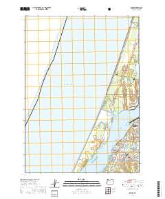
2020 Map of Empire
USGS Topo · Published 2020About this map
The district of Empire serves as a focal point along the eastern shore of Coos Bay, revealing a landscape where coastal infrastructure meets the preserved wilds of the Siuslaw National Forest. This 2020 survey details the expansion of residential street grids alongside significant local landmarks such as Ocean View Memorial Gardens and the historic Empire Cem. The map illustrates the specialized recreational use of the region, specifically along the North Spit, where the Coast Guard-S-Ohv-Trail and Bull Run Ohv Trail wind through the dunes and marshes near Horsfall Lake. To the north, the Southwest Oregon Regional Airport marks the transition into North Bend, while the interior is dotted with coastal water bodies like Bluebill Lake and Jordan Lake, providing a detailed look at the interface between the Pacific Ocean and the industrial and maritime centers of the bay.
Find a feature on this map
67 named features on this map. Tap any name to fly to it.
Don’t see what you’re looking for? This feature index may not catch every label — zoom into the map to look around manually.
Map Details
Editions of this 2020 Empire Map
This is the sole edition of this map. No revisions or reprints were ever made.
Other maps of this area

1896 · Coos Bay
USGS Topo · 1:125,000

1898 · Coos Bay
USGS Topo · 1:125,000

1900 · Coos Bay
USGS Topo · 1:125,000

1923 · Reedsport
USGS Topo · 1:62,500

1942 · Reedsport
USGS Topo · 1:62,500

1942 · Empire
USGS Topo · 1:62,500

1942 · Coos Bay
USGS Topo · 1:62,500

1944 · Empire
USGS Topo · 1:62,500

1945 · Coos Bay
USGS Topo · 1:62,500

1954 · Coos Bay
USGS Topo · 1:250,000