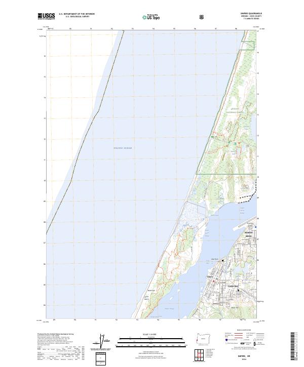
2024 Map of Empire
USGS Topo · Published 2024About this map
The Empire district and the western reaches of North Bend and Coos Bay meet where the industrial shoreline transitions into the protected landscape of the Siuslaw National Forest. This contemporary geography is defined by the massive North Spit landform, which shields the bay from the Pacific Ocean and creates a unique wetland environment featuring Henderson Marsh and Hungryman Cove. For local historians and genealogists, the map provides precise locations for the Empire Cem and Ocean View Memorial Gardens, alongside the infrastructure of the Southwest Oregon Regional Airport. The terrain rises toward Radar Hill and the Empire Range, while recreation trails like the Bull Run Ohv Trail and Wildmare Horse Trl thread through the dunes and lakes of the forest interior.
Find a feature on this map
65 named features on this map. Tap any name to fly to it.
Don’t see what you’re looking for? This feature index may not catch every label — zoom into the map to look around manually.
Map Details
Editions of this 2024 Empire Map
This is the sole edition of this map. No revisions or reprints were ever made.
Other maps of this area

1896 · Coos Bay
USGS Topo · 1:125,000

1898 · Coos Bay
USGS Topo · 1:125,000

1900 · Coos Bay
USGS Topo · 1:125,000

1923 · Reedsport
USGS Topo · 1:62,500

1942 · Reedsport
USGS Topo · 1:62,500

1942 · Empire
USGS Topo · 1:62,500

1942 · Coos Bay
USGS Topo · 1:62,500

1944 · Empire
USGS Topo · 1:62,500

1945 · Coos Bay
USGS Topo · 1:62,500

1954 · Coos Bay
USGS Topo · 1:250,000