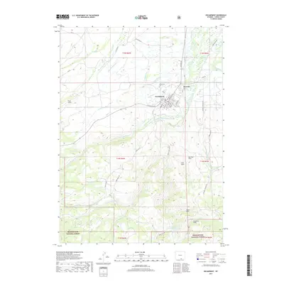
2017 Map of Encampment
USGS Topo · Published 2017About this map
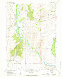
Encampment and neighboring Riverside sit at the northern edge of the Medicine Bow National Forest in Carbon County, where the high plains meet the mountains. This 2017 survey details a landscape defined by ranching and irrigation history, featuring an extensive network of water management projects such as Pilson Ditch Number 1, Grand Valley Ditch, and Wolford Ditch. The town site of Encampment is clearly mapped with its residential grid, including Encampment Cem and local landmarks like Mac Farlane Ave. To the south, the terrain becomes increasingly complex as the N Fork Encampment River and its tributaries, including Copper Cr and Miner Cr, carve through the foothills. Recreation and land management are prominent, evidenced by the Water Valley Fish and Recreation Pond and the numerous BLM and Forest Service access routes like Blackhall Mountain Rd and Silver Spur Rd.
Find a feature on this map
46 named features on this map. Tap any name to fly to it.
Don’t see what you’re looking for? This feature index may not catch every label — zoom into the map to look around manually.
Map Details
Editions of this 2017 Encampment Map
This is the sole edition of this map. No revisions or reprints were ever made.
Other maps of this area

1939 · Saratoga
USGS Topo · 1:125,000

1954 · Rawlins
USGS Topo · 1:250,000

1958 · Rawlins
USGS Topo · 1:250,000

1961 · Red Mountain
USGS Topo · 1:24,000

1961 · Gunst Reservoir
USGS Topo · 1:24,000

1961 · Encampment
USGS Topo · 1:24,000
1961 · Blackhall Mountain
USGS Topo · 1:24,000
1961 · Dudley Creek
USGS Topo · 1:24,000
1961 · Cow Creek Ranch
USGS Topo · 1:24,000
1961 · Cow Creek
USGS Topo · 1:24,000