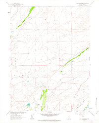
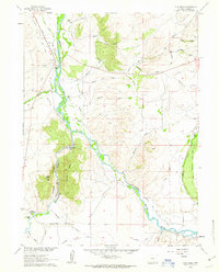
1961 Map of Cow Creek Ranch
USGS Topo · Published 1963About this map
Cow Creek Ranch and several other family-named ranching operations anchor this landscape in the high plains of Carbon County. The map details a sophisticated network of water management, with numerous ditches and wells supporting the cattle economy along watercourses like South Spring Creek and Cow Creek. This reliance on local hydrology is further evidenced by the Anderson Reservoir in the southern portion of the sheet. Industrial and transit lines cross the terrain, including a section of the Union Pacific railroad and a rugged Jeep Trail that climbs the ridges. The southeastern corner is defined by the Encampment River, where the elevation begins to drop towards the river valley. The distribution of Hill Ranch, Trowbridge Ranch, and Silver Spur Ranch illustrates the large-acreage landholdings that characterized this region during the early 1960s.
Find a feature on this map
21 named features on this map. Tap any name to fly to it.
Don’t see what you’re looking for? This feature index may not catch every label — zoom into the map to look around manually.
Map Details
Editions of this 1961 Cow Creek Ranch Map
2 editions found
Other maps of this area

1939 · Saratoga
USGS Topo · 1:125,000

1954 · Rawlins
USGS Topo · 1:250,000

1958 · Rawlins
USGS Topo · 1:250,000

1961 · Red Mountain
USGS Topo · 1:24,000
1961 · Finley Reservoir
USGS Topo · 1:24,000

1961 · Gunst Reservoir
USGS Topo · 1:24,000

1961 · Encampment
USGS Topo · 1:24,000
1961 · Saratoga
USGS Topo · 1:24,000
1961 · Cow Creek
USGS Topo · 1:24,000
1961 · Indian Rocks
USGS Topo · 1:24,000