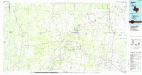
1985 Map of Encino
USGS Topo · Published 1985About this map
Deep South Texas ranchlands and energy resources define this mid-1980s portrait of the region where Jim Hogg, Brooks, Starr, and Hidalgo Counties converge. The landscape is marked by the expansive Alta Mesa Oil Field and Rincon Oil and Gas Field, illustrating the industrial footprint of petroleum extraction across these brushy plains. Historic ranching settlements like San Antonio Viejo, Agua Nueva, and Santa Elena are connected by a network of rural roads, while the Southern Pacific railroad line runs north-south through the eastern corridor, serving towns such as Encino and Linn. Natural water features, often intermittent in this climate, include Laguna Salada and the notable Sal del Rey in the southeast. This survey provides a clear view of the transition from traditional grazing lands to the mid-century oil and gas economy that reshaped the Rio Grande Valley hinterlands.
Find a feature on this map
59 named features on this map. Tap any name to fly to it.
Don’t see what you’re looking for? This feature index may not catch every label — zoom into the map to look around manually.
Map Details
Editions of this 1985 Encino Map
This is the sole edition of this map. No revisions or reprints were ever made.
Other maps of this area

1921 · Falfurrias
USGS Topo · 1:125,000

1922 · La Sal Vieja
USGS Topo · 1:62,500

1923 · Armstrong
USGS Topo · 1:62,500

1928 · Sarita
USGS Topo · 1:125,000

1938 · Falcon
USGS Topo · 1:62,500

1938 · El Sauz
USGS Topo · 1:62,500

1938 · Agua Nueva
USGS Topo · 1:62,500

1938 · Sal Colorada
USGS Topo · 1:62,500

1938 · Cuevitas
USGS Topo · 1:62,500

1939 · Linn
USGS Topo · 1:62,500