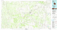
1992 Map of Encino
USGS Topo · Published 1992About this map
Alta Mesa Oil Field and the Strong Oil Field dominate the landscape of the South Texas brush country in the early 1990s, where the boundaries of Brooks, Jim Hogg, Starr, and Hidalgo counties converge. The region is characterized by a pattern of traditional ranching settlements and energy extraction, with many locations such as Agua Nueva and San Antonio Viejo reflecting long-standing Spanish and Mexican land grant histories. Transport follows a distinct north-south corridor through Encino and Rachal, where the rail line passes through Linn Siding. To the southeast, the hypersaline lake Sal del Rey sits as a notable geological landmark, a site harvested for salt since the colonial era. The map details a complex network of ephemeral drainages, including Viboras Creek and Arroyo Grande, which cut through the sandy plains toward the Laguna Madre beyond the sheet's edge.
Find a feature on this map
60 named features on this map. Tap any name to fly to it.
Don’t see what you’re looking for? This feature index may not catch every label — zoom into the map to look around manually.
Map Details
Editions of this 1992 Encino Map
This is the sole edition of this map. No revisions or reprints were ever made.
Other maps of this area

1921 · Falfurrias
USGS Topo · 1:125,000

1922 · La Sal Vieja
USGS Topo · 1:62,500

1923 · Armstrong
USGS Topo · 1:62,500

1928 · Sarita
USGS Topo · 1:125,000

1938 · Falcon
USGS Topo · 1:62,500

1938 · El Sauz
USGS Topo · 1:62,500

1938 · Agua Nueva
USGS Topo · 1:62,500

1938 · Sal Colorada
USGS Topo · 1:62,500

1938 · Cuevitas
USGS Topo · 1:62,500

1939 · Linn
USGS Topo · 1:62,500