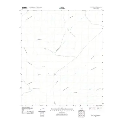
2010 Map of Engine Mountain
USGS Topo · Published 2010About this map
Engine Mountain and Horsefoot Mountain anchor this arid landscape in Cochise County, where isolated ranching outposts have managed the territory into the twenty-first century. High desert drainage patterns are clearly visible, with Horseshoe Wash cutting across the Playas De Los Pinos toward the southern canyons. Local history and land use are centered on the rare water sources found at Indian Spring and Rockhouse Spring, which historically dictated the placement of homesteads like Willow Springs Ranch and Horseshoe Ranch. The road network is sparse, defined by the winding High Lonesome Rd and Indian Springs Rd, reflecting the remote character of this borderland region. A dense system of named draws and canyons, including Millsite Canyon and Old Horseshoe Canyon, provides a detailed record of the local topography used by generations of cattlemen and travelers.
Find a feature on this map
24 named features on this map. Tap any name to fly to it.
Don’t see what you’re looking for? This feature index may not catch every label — zoom into the map to look around manually.
Map Details
Editions of this 2010 Engine Mountain Map
This is the sole edition of this map. No revisions or reprints were ever made.
Other maps of this area

1917 · San Simon
USGS Topo · 1:125,000

1926 · Orange Butte
USGS Topo · 1:62,500

1950 · San Simon
USGS Topo · 1:62,500

1951 · San Simon
USGS Topo · 1:62,500

1954 · Silver City
USGS Topo · 1:250,000

1958 · Silver City
USGS Topo · 1:250,000

1959 · Canador Peak
USGS Topo · 1:62,500

1960 · Duncan
USGS Topo · 1:62,500

1962 · Silver City
USGS Topo · 1:250,000
1962 · San Simon
USGS Topo · 1:62,500