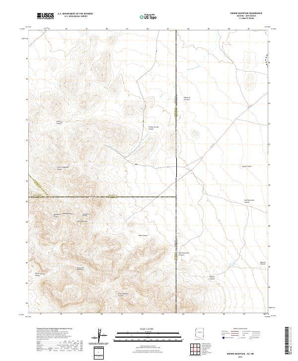
2021 Map of Engine Mountain
USGS Topo · Published 2021About this map
The Peloncillo Mountains dominate this high-desert landscape along the Arizona-New Mexico border, where the convergence of four counties—Cochise, Graham, Greenlee, and Hidalgo—meets among high peaks and deep drainages. At the heart of this rugged survey area, Engine Mtn and Horsefoot Mtn rise above a complex network of canyons, including Antelope Canyon and Little Doubtful Canyon. Water sources are vital but sparse in this arid terrain, marked by Indian Spring and Rockhouse Spring which supported early travel and ranching. The topographical data reveals the transition from high mountainous divides to lower-lying areas like Playas de Los Pinos. This survey captures the isolated character of the borderlands, where few modern roads like Co Rd A021 penetrate the landscape, leaving centuries-old natural landmarks as the primary points of orientation.
Find a feature on this map
28 named features on this map. Tap any name to fly to it.
Don’t see what you’re looking for? This feature index may not catch every label — zoom into the map to look around manually.
Map Details
Editions of this 2021 Engine Mountain Map
This is the sole edition of this map. No revisions or reprints were ever made.
Other maps of this area

1917 · San Simon
USGS Topo · 1:125,000

1926 · Orange Butte
USGS Topo · 1:62,500

1950 · San Simon
USGS Topo · 1:62,500

1951 · San Simon
USGS Topo · 1:62,500

1954 · Silver City
USGS Topo · 1:250,000

1958 · Silver City
USGS Topo · 1:250,000

1959 · Canador Peak
USGS Topo · 1:62,500

1960 · Duncan
USGS Topo · 1:62,500

1962 · Silver City
USGS Topo · 1:250,000
1962 · San Simon
USGS Topo · 1:62,500