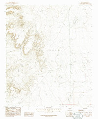
1985 Map of Engle
USGS Topo · Published 1985About this map
The high desert settlement of Engle sits at a critical junction of transport and topography within the Pedro Armendaris No 33 land grant. To the west, the steep elevations of the Fra Cristobal Range dominate the horizon, carved by features like Mc Rae Canyon and the Muerto drainage. The landscape reflects a history of transit and cattle ranching, evidenced by the presence of a Substation, several Corrals, and the path of an Old RR Grade cutting through the arid terrain. Natural water features are scarce but significant, including the intermittent Engle Lake and Cedar Lake to the north. A single Grave noted near the settlement provides a poignant connection to the local residents who once navigated the challenging environment of the Jornada Draw during the late twentieth century.
Find a feature on this map
12 named features on this map. Tap any name to fly to it.
Don’t see what you’re looking for? This feature index may not catch every label — zoom into the map to look around manually.
Map Details
Editions of this 1985 Engle Map
This is the sole edition of this map. No revisions or reprints were ever made.
Other maps of this area

1916 · Salinas Peak
USGS Topo · 1:125,000

1948 · Sowell
USGS Topo · 1:62,500

1948 · Malpais Well
USGS Topo · 1:62,500

1954 · Tularosa
USGS Topo · 1:250,000

1958 · Tularosa
USGS Topo · 1:250,000

1958 · Elephant Butte
USGS Topo · 1:24,000

1959 · Engle
USGS Topo · 1:62,500

1961 · Black Bluffs
USGS Topo · 1:24,000

1961 · Crocker
USGS Topo · 1:24,000

1979 · Truth or Consequences
USGS Topo · 1:100,000