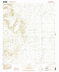
1996 Map of Engle
USGS Topo · Published 2002About this map
The Fra Cristobal Range dominates this landscape, rising sharply above the desert floor of the Jornada del Muerto. This area is defined by the massive land grant of Pedro Armendaris No 33, reflecting the complex history of territorial land management in the region. The small settlement at Engle serves as a focal point near a Substation, while the surrounding terrain is marked by seasonal basins like Engle Lake and Cedar Lake.
Find a feature on this map
14 named features on this map. Tap any name to fly to it.
Don’t see what you’re looking for? This feature index may not catch every label — zoom into the map to look around manually.
Map Details
Editions of this 1996 Engle Map
This is the sole edition of this map. No revisions or reprints were ever made.
Other maps of this area

1916 · Salinas Peak
USGS Topo · 1:125,000

1948 · Sowell
USGS Topo · 1:62,500

1948 · Malpais Well
USGS Topo · 1:62,500

1954 · Tularosa
USGS Topo · 1:250,000

1958 · Tularosa
USGS Topo · 1:250,000

1958 · Elephant Butte
USGS Topo · 1:24,000

1959 · Engle
USGS Topo · 1:62,500

1961 · Black Bluffs
USGS Topo · 1:24,000

1961 · Crocker
USGS Topo · 1:24,000

1979 · Truth or Consequences
USGS Topo · 1:100,000