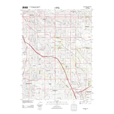
2013 Map of Englewood
USGS Topo · Published 2013About this map
Cherry Hills Village and the southern reaches of Denver define this urban and suburban landscape, where the historic Highline Canal snakes through modern residential developments and established parklands. The map reveals a dense network of neighborhoods including University Park, Glendale, and Wellshire, centered around institutional landmarks like the University of Denver and its Chamberlain Observatory. To the east, the sprawling grounds of Fairmount Cem and Emanuel Cem at Fairmount provide a significant genealogical resource, marking one of the region's primary historic burial sites. Along the western edge, the South Platte River and its accompanying Overland Park Municipal Golf Course highlight the area's ongoing relationship with the river corridor, while numerous smaller waterways such as Goldsmith Gulch and Harvard Gulch drain the surrounding heights into the city's heart.
Find a feature on this map
171 named features on this map. Tap any name to fly to it.
Don’t see what you’re looking for? This feature index may not catch every label — zoom into the map to look around manually.
Map Details
Editions of this 2013 Englewood Map
This is the sole edition of this map. No revisions or reprints were ever made.
Other maps of this area

1890 · East Denver
USGS Topo · 1:125,000

1899 · West Denver
USGS Topo · 1:125,000

1935 · East Denver Nos. 3 and 4
USGS Topo · 1:48,000

1938 · Derby
USGS Topo · 1:24,000

1938 · Long Branch
USGS Topo · 1:24,000

1940 · Englewood
USGS Topo · 1:31,680

1940 · Derby
USGS Topo · 1:31,680

1941 · Long Branch
USGS Topo · 1:31,680

1941 · Fitzsimons
USGS Topo · 1:31,680

1941 · Arvada
USGS Topo · 1:31,680