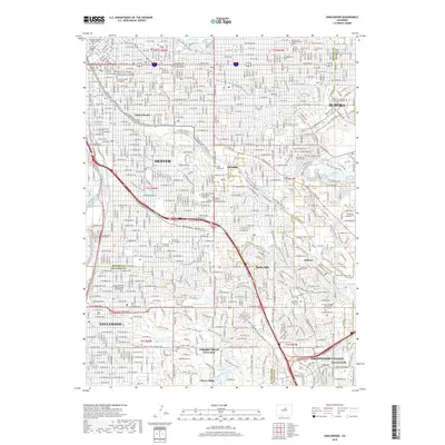
2019 Map of Englewood
USGS Topo · Published 2019About this map
Denver dominates the northern reaches of this study, showcasing the dense street grid and institutional core of the Colorado capital. The landscape is defined by its extensive network of recreational and water management features, most notably the winding course of Cherry Creek and the long, historic path of the High Line Canal Trail. Significant academic and religious institutions are clustered throughout the central portion, including the University of Denver and the Saint John Vianney Theological Seminary.
Find a feature on this map
59 named features on this map. Tap any name to fly to it.
Don’t see what you’re looking for? This feature index may not catch every label — zoom into the map to look around manually.
Map Details
Editions of this 2019 Englewood Map
This is the sole edition of this map. No revisions or reprints were ever made.
Other maps of this area

1890 · East Denver
USGS Topo · 1:125,000

1899 · West Denver
USGS Topo · 1:125,000

1935 · East Denver Nos. 3 and 4
USGS Topo · 1:48,000

1938 · Derby
USGS Topo · 1:24,000

1938 · Long Branch
USGS Topo · 1:24,000

1940 · Englewood
USGS Topo · 1:31,680

1940 · Derby
USGS Topo · 1:31,680

1941 · Long Branch
USGS Topo · 1:31,680

1941 · Fitzsimons
USGS Topo · 1:31,680

1941 · Arvada
USGS Topo · 1:31,680