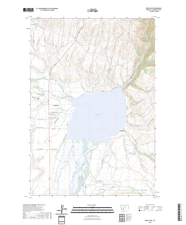
2024 Map of Ennis Lake
USGS Topo · Published 2024About this map
Ennis Lake dominates this Madison County landscape, formed where the Madison River is impounded before it flows north into the narrow Bear Trap Canyon. The settlement of McAllister sits on the western shore, served by the McAllister Cem and a network of local roads like N Meadow Creek Rd. The map illustrates a complex riparian system where North Meadow Creek and South Meadow Creek converge near the lake, alongside the engineered West Madison Canal.
Find a feature on this map
43 named features on this map. Tap any name to fly to it.
Don’t see what you’re looking for? This feature index may not catch every label — zoom into the map to look around manually.
Map Details
Editions of this 2024 Ennis Lake Map
This is the sole edition of this map. No revisions or reprints were ever made.
Other maps of this area

1888 · Three Forks
USGS Topo · 1:250,000

1894 · Three Forks
USGS Topo · 1:250,000

1895 · Three Forks
USGS Topo · 1:250,000

1947 · Bozeman
USGS Topo · 1:250,000

1948 · Bozeman
USGS Topo · 1:250,000

1949 · Ennis
USGS Topo · 1:62,500

1949 · Norris
USGS Topo · 1:62,500

1950 · Harrison
USGS Topo · 1:62,500

1950 · Virginia City
USGS Topo · 1:62,500

1951 · Norris
USGS Topo · 1:62,500