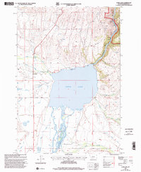
1997 Map of Ennis Lake
USGS Topo · Published 2002About this map
Ennis Lake and the rushing waters of the Madison River dominate this late-twentieth-century landscape in Madison County. The map details a complex hydrologic network including the Fletcher Channel, West Madison Canal, and numerous irrigation ditches that support the valley's ranching and utility needs. Industrial footprints are visible through the Madison Powerplant, multiple Mine Shaft locations, and several Gravel Pit sites.
Find a feature on this map
34 named features on this map. Tap any name to fly to it.
Don’t see what you’re looking for? This feature index may not catch every label — zoom into the map to look around manually.
Map Details
Editions of this 1997 Ennis Lake Map
This is the sole edition of this map. No revisions or reprints were ever made.
Other maps of this area

1888 · Three Forks
USGS Topo · 1:250,000

1894 · Three Forks
USGS Topo · 1:250,000

1895 · Three Forks
USGS Topo · 1:250,000

1947 · Bozeman
USGS Topo · 1:250,000

1948 · Bozeman
USGS Topo · 1:250,000

1949 · Ennis
USGS Topo · 1:62,500

1949 · Norris
USGS Topo · 1:62,500

1950 · Harrison
USGS Topo · 1:62,500

1950 · Virginia City
USGS Topo · 1:62,500

1951 · Norris
USGS Topo · 1:62,500