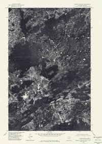
1976 Map of Ensign Lake SW
USGS Topo · Published 1979About this map
Basswood Lake dominates the upper reaches of this 1976 orthophotoquad, representing a significant segment of the international boundary between Ontario and Minnesota. Unlike traditional topographic maps, this aerial perspective provides a literal view of the dense boreal canopy and the complex shoreline of the Boundary Waters region as it existed in the mid-1970s. The intricate network of waterways, including Sunday Lake and Snowbank Lake, illustrates the interconnected glacial landscape that defines the border country. This document preserves the exact physical state of the wilderness before later management changes, showing the raw texture of the forest and the clear, dark reaches of Manomin Lake and its neighbors.
Find a feature on this map
5 named features on this map. Tap any name to fly to it.
Don’t see what you’re looking for? This feature index may not catch every label — zoom into the map to look around manually.
Map Details
Editions of this 1976 Ensign Lake SW Map
This is the sole edition of this map. No revisions or reprints were ever made.
Other maps of this area

1954 · Two Harbors
USGS Topo · 1:250,000

1957 · Two Harbors
USGS Topo · 1:250,000

1957 · Gabbro Lake
USGS Topo · 1:62,500

1957 · Ensign Lake
USGS Topo · 1:62,500

1957 · Basswood Lake
USGS Topo · 1:62,500

1957 · Quetico
USGS Topo · 1:250,000

1958 · Two Harbors
USGS Topo · 1:250,000

1964 · Two Harbors
USGS Topo · 1:250,000

1968 · Quetico
USGS Topo · 1:250,000
1976 · Basswood Lake SE
USGS Topo · 1:24,000