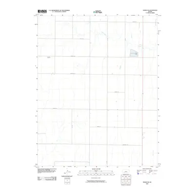
2009 Map of Ensign SE
USGS Topo · Published 2009About this map
Concord Cemetery stands as a focal point for genealogical interest in this rural portion of Ford County, Kansas. The landscape is defined by the headwaters and drainages of Mulberry Creek in the north and Bluff Creek in the south, illustrating the subtle topography of the High Plains. The road network follows a strict sectional grid, yet the naming conventions—such as Warrior Rd, Whirlwind Rd, and Windy Rd—reflect the local character and environmental conditions of the region. This 2009 survey by the U.S. Geological Survey documents a primarily agricultural area where historical land divisions remain the dominant structural feature, anchored by isolated landmarks like Wilburn Rd and Wrangler Rd.
Find a feature on this map
15 named features on this map. Tap any name to fly to it.
Don’t see what you’re looking for? This feature index may not catch every label — zoom into the map to look around manually.
Map Details
Editions of this 2009 Ensign SE Map
This is the sole edition of this map. No revisions or reprints were ever made.
Other maps of this area

1892 · Meade
USGS Topo · 1:125,000

1892 · Dodge
USGS Topo · 1:125,000

1892 · Spearville
USGS Topo · 1:125,000

1894 · Spearville
USGS Topo · 1:125,000

1896 · Ashland
USGS Topo · 1:125,000

1955 · Pratt
USGS Topo · 1:250,000

1955 · Dodge City
USGS Topo · 1:250,000

1958 · Dodge City
USGS Topo · 1:250,000

1959 · Pratt
USGS Topo · 1:250,000

1959 · Dodge City
USGS Topo · 1:250,000