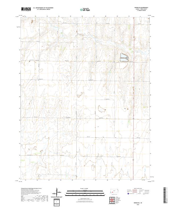
2022 Map of Ensign SE
USGS Topo · Published 2022About this map
Concord Cem serves as a lone local landmark in this corner of Ford County, situated among the section lines of the Public Land Survey System. The landscape is defined by the intermittent drainage of Mulberry Cr in the north and the headwaters of Bluff Cr to the south. This region of Kansas exhibits a highly regularized grid of rural infrastructure, where named thoroughfares like Warrior Rd and Whirlwind Rd track precisely along township and range boundaries such as t28s r26w. The map illustrates a strictly managed agricultural environment where roads such as Upland Rd and Valley Rd provide access to the vast interior sections of the High Plains, reflecting a spatial organization established by nineteenth-century land ordinances that persists into the modern day.
Find a feature on this map
23 named features on this map. Tap any name to fly to it.
Don’t see what you’re looking for? This feature index may not catch every label — zoom into the map to look around manually.
Map Details
Editions of this 2022 Ensign SE Map
This is the sole edition of this map. No revisions or reprints were ever made.
Other maps of this area

1892 · Meade
USGS Topo · 1:125,000

1892 · Dodge
USGS Topo · 1:125,000

1892 · Spearville
USGS Topo · 1:125,000

1894 · Spearville
USGS Topo · 1:125,000

1896 · Ashland
USGS Topo · 1:125,000

1955 · Pratt
USGS Topo · 1:250,000

1955 · Dodge City
USGS Topo · 1:250,000

1958 · Dodge City
USGS Topo · 1:250,000

1959 · Pratt
USGS Topo · 1:250,000

1959 · Dodge City
USGS Topo · 1:250,000