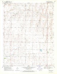
1969 Map of Ensign SE
USGS Topo · Published 1971About this map
The Old Indian Treaty Boundary slices diagonally across this portion of Ford County, providing a stark historical demarcation through the townships of Concord and Wilburn. This 1969 survey illustrates a landscape primarily defined by agricultural section lines and the meandering path of Mulberry Creek in the north. The infrastructure of the late 1960s is evident through several pipelines crossing the territory and a localized Gaging Station. For genealogists and local historians, the Concord Cem stands as a primary landmark of the area's early settlement. The map also records mid-century communication technology, noted by a Radio Tower in the southeastern quadrant, reflecting the gradual modernization of this rural Kansas prairie.
Find a feature on this map
8 named features on this map. Tap any name to fly to it.
Don’t see what you’re looking for? This feature index may not catch every label — zoom into the map to look around manually.
Map Details
Editions of this 1969 Ensign SE Map
This is the sole edition of this map. No revisions or reprints were ever made.
Other maps of this area

1892 · Meade
USGS Topo · 1:125,000

1892 · Dodge
USGS Topo · 1:125,000

1892 · Spearville
USGS Topo · 1:125,000

1894 · Spearville
USGS Topo · 1:125,000

1896 · Ashland
USGS Topo · 1:125,000

1955 · Pratt
USGS Topo · 1:250,000

1955 · Dodge City
USGS Topo · 1:250,000

1958 · Dodge City
USGS Topo · 1:250,000

1959 · Pratt
USGS Topo · 1:250,000

1959 · Dodge City
USGS Topo · 1:250,000