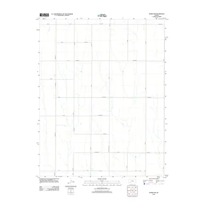
2012 Map of Ensign SW
USGS Topo · Published 2012About this map
Mulberry Cr winds through the northwestern corner of this Ford County landscape, providing a natural break in the highly structured grid of the Kansas plains. This survey illustrates a rural interior defined by its vast network of section-line roads, such as Upland Rd and Wilburn Rd, which facilitate the region's agricultural economy. The land is marked by numerous drainage channels that feed into larger systems like Crooked Creek Rd, reflecting the subtle topographic shifts that dictate local water management and property boundaries. For the local historian, the map preserves the specific 21st-century names of these thoroughfares, including Warrior Rd, Wildfire Rd, and Wrangler Rd, offering a detailed view of how contemporary access and infrastructure have been laid over the historic township and range system.
Find a feature on this map
27 named features on this map. Tap any name to fly to it.
Don’t see what you’re looking for? This feature index may not catch every label — zoom into the map to look around manually.
Map Details
Editions of this 2012 Ensign SW Map
This is the sole edition of this map. No revisions or reprints were ever made.
Other maps of this area

1892 · Meade
USGS Topo · 1:125,000

1892 · Dodge
USGS Topo · 1:125,000

1955 · Dodge City
USGS Topo · 1:250,000

1958 · Dodge City
USGS Topo · 1:250,000

1959 · Dodge City
USGS Topo · 1:250,000

1967 · Minneola
USGS Topo · 1:24,000

1969 · Meade NE
USGS Topo · 1:24,000
1969 · South Dodge
USGS Topo · 1:24,000
1969 · Fowler
USGS Topo · 1:24,000
1969 · Haggard
USGS Topo · 1:24,000