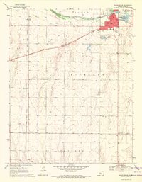
1969 Map of South Dodge
USGS Topo · Published 1971About this map
Arkansas River flows along the northern edge of this Ford County landscape, where the settlement of South Dodge and the industrial fringes of Dodge City transition into the agricultural expanses of Fairview, Richland, and Concord. A notable historical marker on this 1969 survey is the Old Indian Treaty Boundary, which cuts vertically across the western sections, providing a clear reference for researchers of early Kansas land divisions.
Find a feature on this map
27 named features on this map. Tap any name to fly to it.
Don’t see what you’re looking for? This feature index may not catch every label — zoom into the map to look around manually.
Map Details
Editions of this 1969 South Dodge Map
3 editions found
Other maps of this area

1892 · Dodge
USGS Topo · 1:125,000

1892 · Spearville
USGS Topo · 1:125,000

1894 · Spearville
USGS Topo · 1:125,000

1955 · Pratt
USGS Topo · 1:250,000

1955 · Dodge City
USGS Topo · 1:250,000

1958 · Dodge City
USGS Topo · 1:250,000

1959 · Pratt
USGS Topo · 1:250,000

1959 · Dodge City
USGS Topo · 1:250,000

1968 · Dodge City
USGS Topo · 1:24,000
1968 · Dodge City SW
USGS Topo · 1:24,000