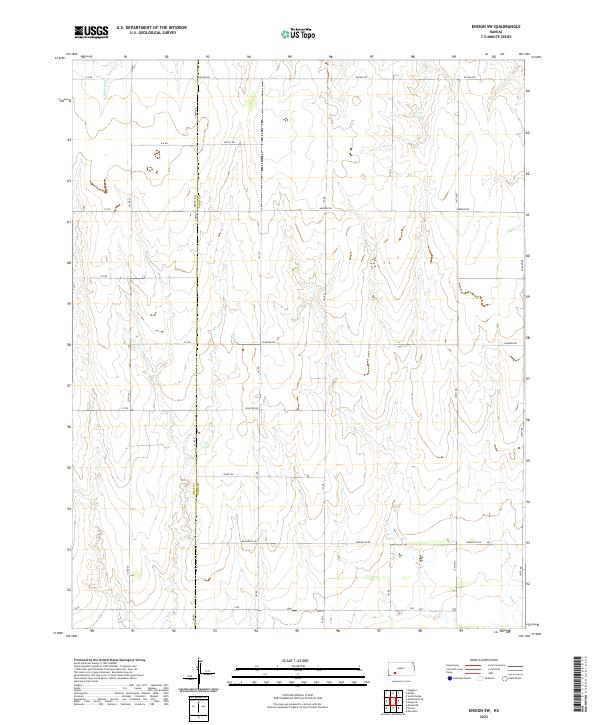
2022 Map of Ensign SW
USGS Topo · Published 2022About this map
Mulberry Cr meanders through the northwestern corner of this Kansas landscape, defining a terrain shaped by gradual elevation changes and the organized grid of High Plains agriculture. The boundary between Gray County and Ford County runs vertically through the center of the survey, a political line that anchors the section-line roads defining local travel. The road network is remarkably systematic, with alphabetical routes like A A Rd and B B Rd crossing numerical north-south connectors such as 100th Rd and 105th Rd. Descriptive local names like Wrangler Rd, Wildfire Rd, and Warrior Rd suggest the cattle and ranching heritage of the region. This 2022 U.S. Geological Survey map provides a clear record of the modern rural infrastructure, showing how township and range lines continue to dictate the placement of farmsteads and access routes.
Find a feature on this map
29 named features on this map. Tap any name to fly to it.
Don’t see what you’re looking for? This feature index may not catch every label — zoom into the map to look around manually.
Map Details
Editions of this 2022 Ensign SW Map
This is the sole edition of this map. No revisions or reprints were ever made.
Other maps of this area

1892 · Meade
USGS Topo · 1:125,000

1892 · Dodge
USGS Topo · 1:125,000

1955 · Dodge City
USGS Topo · 1:250,000

1958 · Dodge City
USGS Topo · 1:250,000

1959 · Dodge City
USGS Topo · 1:250,000

1967 · Minneola
USGS Topo · 1:24,000

1969 · Meade NE
USGS Topo · 1:24,000
1969 · South Dodge
USGS Topo · 1:24,000
1969 · Fowler
USGS Topo · 1:24,000
1969 · Haggard
USGS Topo · 1:24,000