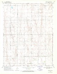
1969 Map of Ensign SW
USGS Topo · Published 1971About this map
Wilburn and East Hess townships define this agricultural landscape in southwestern Kansas, where the survey captures the region as it appeared in the late 1960s. The terrain is a network of undulating drainage patterns and intermittent watercourses, straddling the Gray Co Ford Co boundary line. Human activity in this rural expanse is marked primarily by infrastructure for resource extraction and transport, evidenced by several Well sites and a prominent Pipeline that cuts across the sections of Concord and Wilburn. The map provides a precise look at the township-and-range land division system, showing the established grid of section lines and early roads that supported the remote farming and ranching operations of Ford and Gray counties during this era.
Find a feature on this map
6 named features on this map. Tap any name to fly to it.
Don’t see what you’re looking for? This feature index may not catch every label — zoom into the map to look around manually.
Map Details
Editions of this 1969 Ensign SW Map
This is the sole edition of this map. No revisions or reprints were ever made.
Other maps of this area

1892 · Meade
USGS Topo · 1:125,000

1892 · Dodge
USGS Topo · 1:125,000

1955 · Dodge City
USGS Topo · 1:250,000

1958 · Dodge City
USGS Topo · 1:250,000

1959 · Dodge City
USGS Topo · 1:250,000

1967 · Minneola
USGS Topo · 1:24,000

1969 · Meade NE
USGS Topo · 1:24,000
1969 · South Dodge
USGS Topo · 1:24,000
1969 · Fowler
USGS Topo · 1:24,000
1969 · Haggard
USGS Topo · 1:24,000