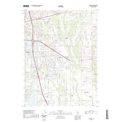
2022 Map of Enterprise
USGS Topo · Published 2022About this map
Enterprise and the eastern reaches of Redding define this portion of the Central Sacramento Valley in northern California. The landscape is shaped by the southward flow of the Sacramento River, which meets Clear Creek at the southwestern corner of the sheet. Urban development radiates from major corridors like Lake Blvd E and Airport Rd, while educational institutions such as Simpson University and the Shasta Bible College and Graduate School occupy the northern hills. Further south, the terrain opens into the agricultural and riparian stretches of Churn Creek Bottom and the Stillwater Plains. This survey illustrates the modern layout of regional transit hubs, notably the Redding Municipal Airport, and established local landmarks like Lawncrest Memorial Park and Loomis Corners, showing the integration of residential growth within a complex network of creeks including Churn Cr and Stillwater Cr.
Find a feature on this map
222 named features on this map. Tap any name to fly to it.
Don’t see what you’re looking for? This feature index may not catch every label — zoom into the map to look around manually.
Map Details
Editions of this 2022 Enterprise Map
This is the sole edition of this map. No revisions or reprints were ever made.
Other maps of this area

1890 · Red Bluff
USGS Topo · 1:250,000

1894 · Red Bluff
USGS Topo · 1:250,000

1901 · Redding
USGS Topo · 1:125,000

1932 · Olinda
USGS Topo · 1:31,680

1935 · Olinda
USGS Topo · 1:31,680

1944 · Redding
USGS Topo · 1:62,500

1944 · Tuscan Buttes
USGS Topo · 1:62,500

1946 · Redding
USGS Topo · 1:62,500

1947 · Tuscan Buttes
USGS Topo · 1:62,500

1947 · Anderson
USGS Topo · 1:62,500