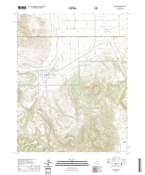
2023 Map of Enterprise
USGS Topo · Published 2023About this map
The town of Enterprise serves as a vital agricultural hub at the southern edge of the Escalante Valley, where the high desert meets the northern slopes of the Bull Valley Mountains. This 2023 survey illustrates a landscape defined by water management and family history, evidenced by features like the Gary and Joyce Holt Reservoir and three distinct burial grounds: the Enterprise City Cem, Winsor Memorial Cem, and Holt Cem. The community is situated where Shoal Creek emerges from the surrounding highlands, transitioning from the dense woodland of the Dixie National Forest to the irrigated grids of the valley floor. To the southeast, the terrain rises sharply toward Big Mountain, while the southern reaches of the map include the historic site of Mountain Meadow. The intricate network of seasonal drainages, including Twin Springs Creek and Bullrush Creek, highlights the complex hydrology required to sustain this high-altitude settlement.
Find a feature on this map
53 named features on this map. Tap any name to fly to it.
Don’t see what you’re looking for? This feature index may not catch every label — zoom into the map to look around manually.
Map Details
Editions of this 2023 Enterprise Map
This is the sole edition of this map. No revisions or reprints were ever made.
Other maps of this area

1885 · St. George
USGS Topo · 1:250,000

1891 · St. George
USGS Topo · 1:250,000

1953 · Cedar City
USGS Topo · 1:250,000

1958 · Cedar City
USGS Topo · 1:250,000

1962 · Cedar City
USGS Topo · 1:250,000
1972 · Pinto
USGS Topo · 1:24,000

1972 · Pinon Point
USGS Topo · 1:24,000
1972 · Beryl Junction
USGS Topo · 1:24,000
1972 · Central West
USGS Topo · 1:24,000
1972 · Maple Ridge
USGS Topo · 1:24,000