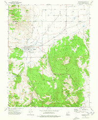
1972 Map of Enterprise
USGS Topo · Published 1976About this map
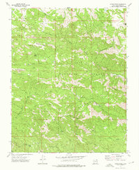
Enterprise sits at the transition between the agricultural flats of the Escalante Valley and the rising timber of the Dixie National Forest. This 1970s survey documents a landscape defined by water management and high-desert geography, where Shoal Creek and Spring Creek flow toward the settlement while numerous springs like Pendleton Spring and Rose Spring dot the more mountainous southern terrain. Genealogists will find three distinct burial sites, including the Winsor Mem Cem and the more remote Holt Cem in Holt Canyon. The presence of a Rodeo Ground and a Landing Strip near the town center reflects the civic infrastructure of the era, while the rugged southern reaches are characterized by peaks like Big Mountain and the winding course of Bull Valley Creek.
Find a feature on this map
35 named features on this map. Tap any name to fly to it.
Don’t see what you’re looking for? This feature index may not catch every label — zoom into the map to look around manually.
Map Details
Editions of this 1972 Enterprise Map
This is the sole edition of this map. No revisions or reprints were ever made.
Other maps of this area

1885 · St. George
USGS Topo · 1:250,000

1891 · St. George
USGS Topo · 1:250,000

1953 · Cedar City
USGS Topo · 1:250,000

1958 · Cedar City
USGS Topo · 1:250,000

1962 · Cedar City
USGS Topo · 1:250,000
1972 · Pinto
USGS Topo · 1:24,000

1972 · Pinon Point
USGS Topo · 1:24,000
1972 · Beryl Junction
USGS Topo · 1:24,000
1972 · Central West
USGS Topo · 1:24,000
1972 · Maple Ridge
USGS Topo · 1:24,000