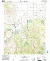
2002 Map of Enterprise
USGS Topo · Published 2005About this map
Enterprise sits at the southern edge of the Escalante Valley, where the open desert floor meets the rising timber of the Dixie National Forest. This 2002 revision shows a community tied to the land, anchored by the Enterprise Work Center and the Pine Valley Ranger District administration site. The town's layout is structured by irrigation and water management, with Shoal Creek and Spring Creek framing the settlement area.
Find a feature on this map
35 named features on this map. Tap any name to fly to it.
Don’t see what you’re looking for? This feature index may not catch every label — zoom into the map to look around manually.
Map Details
Editions of this 2002 Enterprise Map
This is the sole edition of this map. No revisions or reprints were ever made.
Other maps of this area

1885 · St. George
USGS Topo · 1:250,000

1891 · St. George
USGS Topo · 1:250,000

1953 · Cedar City
USGS Topo · 1:250,000

1958 · Cedar City
USGS Topo · 1:250,000

1962 · Cedar City
USGS Topo · 1:250,000
1972 · Pinto
USGS Topo · 1:24,000

1972 · Pinon Point
USGS Topo · 1:24,000
1972 · Beryl Junction
USGS Topo · 1:24,000
1972 · Central West
USGS Topo · 1:24,000
1972 · Maple Ridge
USGS Topo · 1:24,000