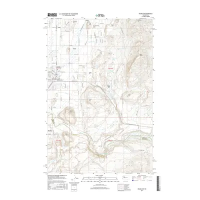
2017 Map of Enumclaw
USGS Topo · Published 2017About this map
The Enumclaw plateau meets the foothills of the Cascades in this detailed 2017 study, where the town of Enumclaw serves as the primary gateway to the mountains. This landscape is defined by the winding course of the White River, which marks the boundary between King and Pierce counties. To the south, the Mud Mountain Lake reservoir and the Weyerhauser Mainline Rd indicate the region's long-standing connection to industrial timber management and flood control.
Find a feature on this map
111 named features on this map. Tap any name to fly to it.
Don’t see what you’re looking for? This feature index may not catch every label — zoom into the map to look around manually.
Map Details
Editions of this 2017 Enumclaw Map
This is the sole edition of this map. No revisions or reprints were ever made.
Other maps of this area

1897 · Tacoma
USGS Topo · 1:125,000

1900 · Tacoma
USGS Topo · 1:125,000

1913 · Cedar Lake
USGS Topo · 1:125,000

1942 · Lake Tapps
USGS Topo · 1:62,500

1944 · Lake Tapps
USGS Topo · 1:62,500

1949 · Black Diamond
USGS Topo · 1:24,000

1953 · Eagle Gorge
USGS Topo · 1:24,000

1953 · Cumberland
USGS Topo · 1:24,000
1956 · Buckley
USGS Topo · 1:24,000
1956 · Wilkeson
USGS Topo · 1:24,000